Campaign reveals new flood risk map and calls for change


The map shows which areas are in flood zone 2 and 3, if and where there are flood defences in place, the flood risk from rivers and the sea, flood storage areas and if there are shoreline management plans.
Boston and Skegness, Louth and Horncastle and South Holland and the Deepings are included in the list of ‘at risk’ areas provided by the campaign.
Advertisement
Hide AdAdvertisement
Hide AdIt claims that data reveals significant gaps in the protection for communities from future flooding risk.
According to ‘We are here’, this week the Environment Agency has issued over 100 flood warnings in England. One of the areas that has been mapped includes Environment Secretary of State Therese Coffey’s constituency, Suffolk Coastal. The Minister responsible for flooding, Rebecca Pow MP’s constituency Taunton and Deane was also one of the locations highlighted to be at risk of flooding.
To combat the impact of flooding on local communities and housing, ‘We Are Here’ is campaigning for a ‘fairer planning system’ which involves people in decision-making and puts the power to act on climate change firmly at a local level.
The campaign has taken the opportunity of the Levelling Up and Regeneration Bill which Rights Community Action say presents an opportunity to place the long-term resilience of communities at the heart of the planning system.
Advertisement
Hide AdAdvertisement
Hide AdThe need for change was recognised in Chris Skidmore MP’s recently published Net Zero Review which set out the need for Government to ensure that housing and infrastructure take flooding vulnerability into account in the planning process. The review recognises the economic implications of flood damage and recommends a Land Use Framework that should consider flood protection.
Naomi Luhde-Thompson, Director of Rights: Community: Action said: “The climate crisis is already here, and it’s affecting communities across England as demonstrated by this new map. People have a right to be involved in decisions about how to best tackle the climate crisis. The Government urgently needs to make changes that empower people to take action through the planning system.”.
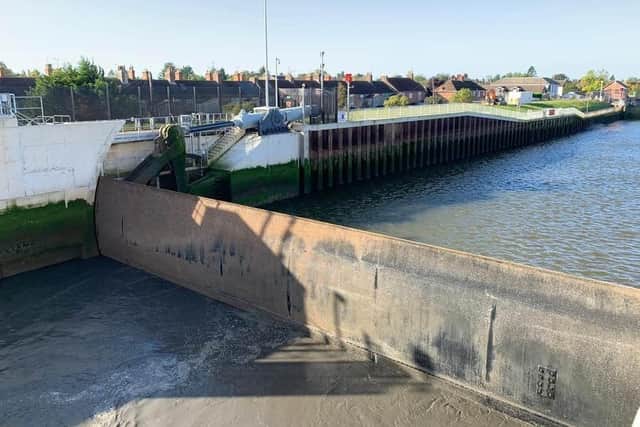
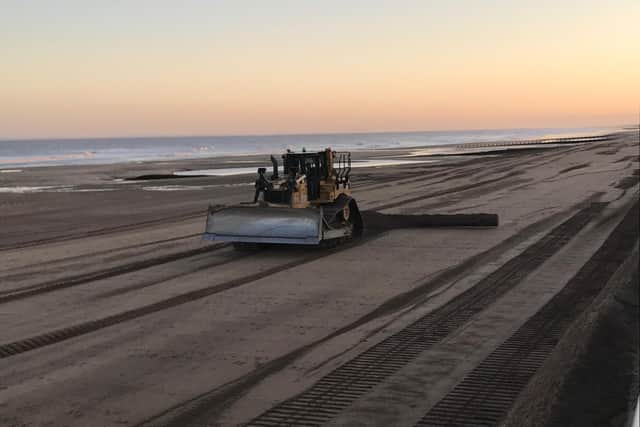
Lincolnshire World spoke to the Environment Agency who told us the Boston Barrier Scheme and the annual beach nourishment along the East Lindsey coast have produced better protection for these areas.
An Environment Agency spokesperson said:
“We work closely with partners to reduce the risk of flooding to people living around Skegness and Boston. The land around Boston and Skegness is flat, low lying and almost entirely below sea level so there are still some areas vulnerable to flooding.
Advertisement
Hide AdAdvertisement
Hide Ad“However, since the £120m Boston Barrier Scheme’s primary barrier gate was declared officially operational in December 2020 it has provided better protection for 13,732 properties in the area. We also carry out annual beach renourishment from Saltfleet to Gibraltar Point to better protect those living along the Lincolnshire Coast.
“Flooding can never be fully prevented and we recommend people sign up to our free warning service by calling 0345 9881188 or visiting https://www.gov.uk/sign-up-for-flood-warnings.”