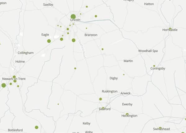
New map reveals number and spread of deaths due to Covid-19 across Sleaford and Lincolnshire


The map can be viewed here.
The data, from the Office for National Statistics, shows where some of the worst hit areas have been for the months of March, April and May.
The figures exclude the deaths of non-residents in the area and are included when COVID-19 was the underlying cause or was mentioned on the death certificate as a contributory factor.
Advertisement
Advertisement
ONS figures see some delays while information is filtered through to them.
The map shows 24 deaths in Sleaford and the surrounding area. One of the postcodes with the highest numbers is the Heckington with five, while Sleaford East also counted five deaths compared to only one in the west of the town.
The breakdown for Sleaford and surrounding district is:
Ancaster, Caythorpe and Claypole: 2
Corby Glen, Ropsley and Grantham Outskirts: 1
Heckington: 5
Morton and Billingborough: 1
Metheringham, Nocton and Potterhanworth: 2
Navenby, Harmston and Brant Broughton: 2
Ruskington North and Billinghay: 1
Ruskington South, Leasingham and Osbournby: 4
Ruskington West and Cranwell: 0
Sleaford East: 5
Sleaford West: 1
ONS figures have revealed a number of patterns nationally, including that people were dying at more than double the rate in the poorest areas compared to the richest and that deprived areas are disproportionately hit by COVID-19.
Some other key figures from the interactive map include:
Bourne had 19 deaths, with 10 in Bourne West and nine in Bourne East.
Advertisement
Advertisement
Skegness has 12 in total, with half of those deaths in Skegness South.
Boston registers 18 deaths including five in Skirbeck, and four each in the Central and North, and Fishtoft and Wyberton East, areas.
Spalding South West has 11 deaths recorded in the figures, contributing the most to the total of 16 deaths in the town.
Grantham has 11 deaths in total, with five of those in the Grantham North West area.