
COLUMN: Why does Lincolnshire flood and what does the EA do about it?
Lincolnshire is one of the most engineered landscapes in the country.
From the 1600s onwards, local workers and Dutch engineers drained the marshes, dug long straight drains, built embankments and installed early pumps to create the farmland we know today. Their work shaped the county, but it also means much of our land now sits close to, or below, sea level. Water doesn’t always flow away by itself; in many places it must be pumped. Our Internal Drainage Boards play a particularly important role in keeping the networks running.

Today, more than 190,000 properties in Lincolnshire are at risk from rivers and the sea, and over 65,000 from surface water. That’s before you even count the huge areas of farmland that play a massive role in our economy.
The Government is investing heavily in reducing flood risk. The Environment Agency is delivering the Government’s flood and coastal risk management programme, with £2.65 billion being invested over 2024/25 and 2025/26 to build new defences and improve existing ones. We must be realistic though: funding isn’t endless. We make tough decisions every day to get the most benefit from every pound, always putting people’s safety first.

Maintenance is a big part of that. It includes cutting grass on embankments to keep them strong, clearing weeds to help rivers flow, and managing the mechanical structures that control water. We also dredge where it genuinely helps, but it isn’t a silver bullet. Dredging is far less effective when downstream levels stay high, such as in tidal areas, pumped lowland watercourses or places with narrow bridges and other bottlenecks. CIWEM (Chartered Institution of Water and Environmental Management) explain this in their report Floods and Dredging: A Reality Check.
An example of our work is set out in the Steeping Catchment Action Plan. After the Wainfleet Relief Channel bank failed in June 2019 and caused major flooding in Wainfleet St Mary, we repaired the breach and have since worked with councils, the Lindsey Marsh Drainage Board and other partners to strengthen long‑term resilience across the area.
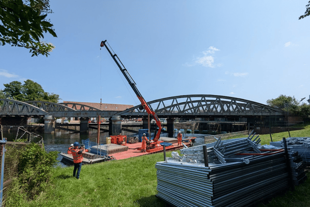
We are also currently refurbishing the Grand Sluice in Boston, this project will help to better protect 9,000 homes and 25,000 hectares of farmland. You can read more here: £15 million refurbishment on Boston’s Grand Sluice begins.
We’re only one of several organisations involved in managing water and reducing flood risk in Lincolnshire though. Internal Drainage Boards, water companies and local authorities all have important roles too. It can be confusing who deals with what there is a helpful guide here: Who has responsibilities for managing flooding?
Our teams work around the clock to prepare for whatever comes next. But many people still don’t realise they live in an area at risk of flooding until the water is already rising. If you take one thing from this article, let it be this: please check your flood risk. It only takes a few minutes at Gov.UK and it’s the first step in protecting what matters most.
We all have a part to play. Once you know your risk, make a simple plan. Where are your important documents? Do you know how to turn off your gas, electricity and water? Who would you call? The National Flood Forum has excellent advice on all of this, including how you may get hold of sandbags.
And finally, make sure you get our free flood warnings at Gov.UK. They give you precious time to move valuables, protect your home and keep your family safe.
We can’t prevent every flood, but together we can reduce the impact. By checking your risk, making a plan and acting on warnings, you’re helping build a more resilient Lincolnshire for all of us.
This column has been provided by Leigh Edlin, area director for Lincolnshire and Northamptonshire at the Environment Agency