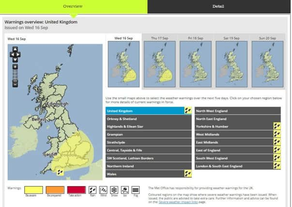
Updated warning for wind, heavy rain and thunderstorms across East of England


The band of rain stems from a complex area of low pressure, expected to deepen over the Bay of Biscay later today, before pushing north towards the UK.
The band of rain stems from a complex area of low pressure over the Bay of Biscay that has pushed north towards the UK.
Advertisement
Hide AdAdvertisement
Hide AdThe rain will move across southern areas this morning, before spreading north through the afternoon and into Thursday before clearing during the day.
Warning details, updated at 11am on Wednesday and valid through until 7am on Thursday: Persistent and at times heavy rain is expected to spread from south to north during Wednesday, this affecting parts of SE Wales and much of southern, southeastern and central England.
Rain should ease from the southwest later today, persisting across the north and east of the warning area overnight before finally clearing from the east early Thursday morning.
Some heavy and thundery showers could also develop across East Anglia and southeast England during the afternoon. Strong and gusty winds are also expected, with gales in exposure.
Advertisement
Hide AdAdvertisement
Hide AdLightning associated with the afternoon showers across East Anglia and SE England will be an additional hazard.
Furthermore, thunderstorms developing across the southeast and East Anglia Wednesday afternoon have the potential to generate 15-25 mm of rain in a few hours.
Disruption is possible from localised flooding from fast responding water courses and standing water.
Check the latest weather warnings at metoffice.gov.uk.